For example, during summer solstice the sun in Nelson sets at 237 degrees SW (north is 0 / 360) and at winter solstice it sets at 301 degrees NW, meaning there is a 64 degree difference between the apparent position of the sun at sunset. See the Victoria University sun path diagrams for more information, or check out the solar calculator for actual azimuth angles in New Zealand.
There is also a useful article by Chris Webster from Met Service that clearly explains how the sun appears to move across the sky at various times in NZ:
http://blog.metservice.com/2009/11/how-the-sun-moves-across-the-sky/
In case it is removed, I have replicated it below.
As we approach summer in NZ, the Sun is getting higher in the sky and is increasingly warming the Earth and the air around us. In the early 1600s Galileo Galilei explained that the Earth goes around the Sun, but there’s no reason why we can’t discuss the apparent movement of the Sun across the sky, as you see it from a frame of reference fixed to the Earth. Let’s do that, and investigate the different ways that the Sun drives our seasons.
On about 22nd December in the Southern Hemisphere we hit the summer solstice. The movement of the Sun across the sky on that date is like this:
If your house has a south-facing wall you may be noticing that it’s getting some direct sunlight in the early morning or late evening these days.
You can compute how high the Sun gets in the sky at your place by first letting the point directly over your head be 90° angle above your horizon. I’ll explain what happens at an equinox, then I’ll go into the solstice computation.
• At the equinoxes
On about 22nd March and 22nd September the Sun is directly overhead the equator. At your place the Sun reaches a maximum angle of 90° minus your latitude.
On about 22nd March and 22nd September the Sun is directly overhead the equator. At your place the Sun reaches a maximum angle of 90° minus your latitude.
For example, the latitude of North Island is approximately 40°S (you can be more precise for your location by looking at an atlas). So, at an equinox, the Sun reaches a maximum elevation angle of 50° above the horizon.
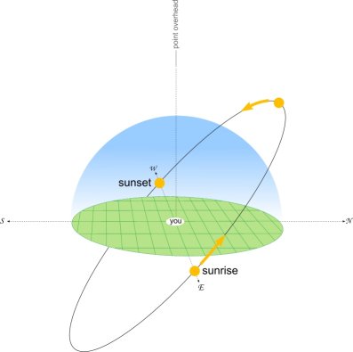
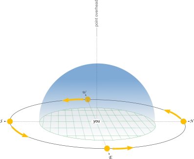
How the Sun moves over NZ on about 22nd March and September. It rises exactly in the east, and sets exactly in the west.
• At the solstices
At the December solstice the Sun has moved to its southernmost point, directly overhead latitude 23°S, called Tropic of Capricorn . E.g. at Rockhampton the Sun will reach 90° directly overhead around midday on 22 December.
At the December solstice the Sun has moved to its southernmost point, directly overhead latitude 23°S, called Tropic of Capricorn . E.g. at Rockhampton the Sun will reach 90° directly overhead around midday on 22 December.
Over North Island, the elevation of the Sun increases to a maximum of 50° plus the 23° (the tilt of the Earth’s axis ), i.e. 73°, as shown in the animation at the start of this post. That’s pretty high in the sky. And now, in November, you can notice how high the Sun’s getting in the middle of a sunny day by seeing how short your shadow is.
In the depths of winter over North Island the Sun only reaches 50° - 23° = 27° above the horizon (see the animation below), which is not very high  Roll on summer.
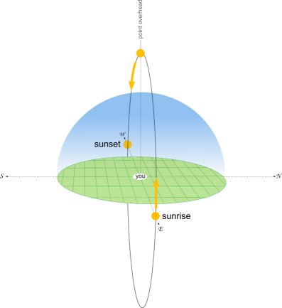
For interest, you may have noticed that in the tropics the duration of sunset is short as the Sun sinks almost straight down below the horizon. It’s a similar story for sunrise. The next diagram shows how the Sun moves on the equator.
At the South Pole, the Sun moves parallel with the horizon, always keeping the same elevation, as shown below. Nearer the Antarctic coast, e.g. at Scott Base, the Sun rises very gradually. Even on 22 Dec it doesn’t get very high in the sky there (about 35° max) and, in winter, the Sun doesn’t even make it above the horizon as it goes around.
To protect our eyes we never look directly at the Sun. But, as I alluded earlier, we can infer the Sun’s position from the shadows it casts. I remember Augie Auer quoted a rough rule of thumb, that if your shadow is shorter than your height you should be protecting yourself from the sun. In other words, if the Sun is higher than 45° elevation, you are more likely to get sunburn. I hope this post has given you a better understanding of why we get these higher Sun elevations in the summer months.
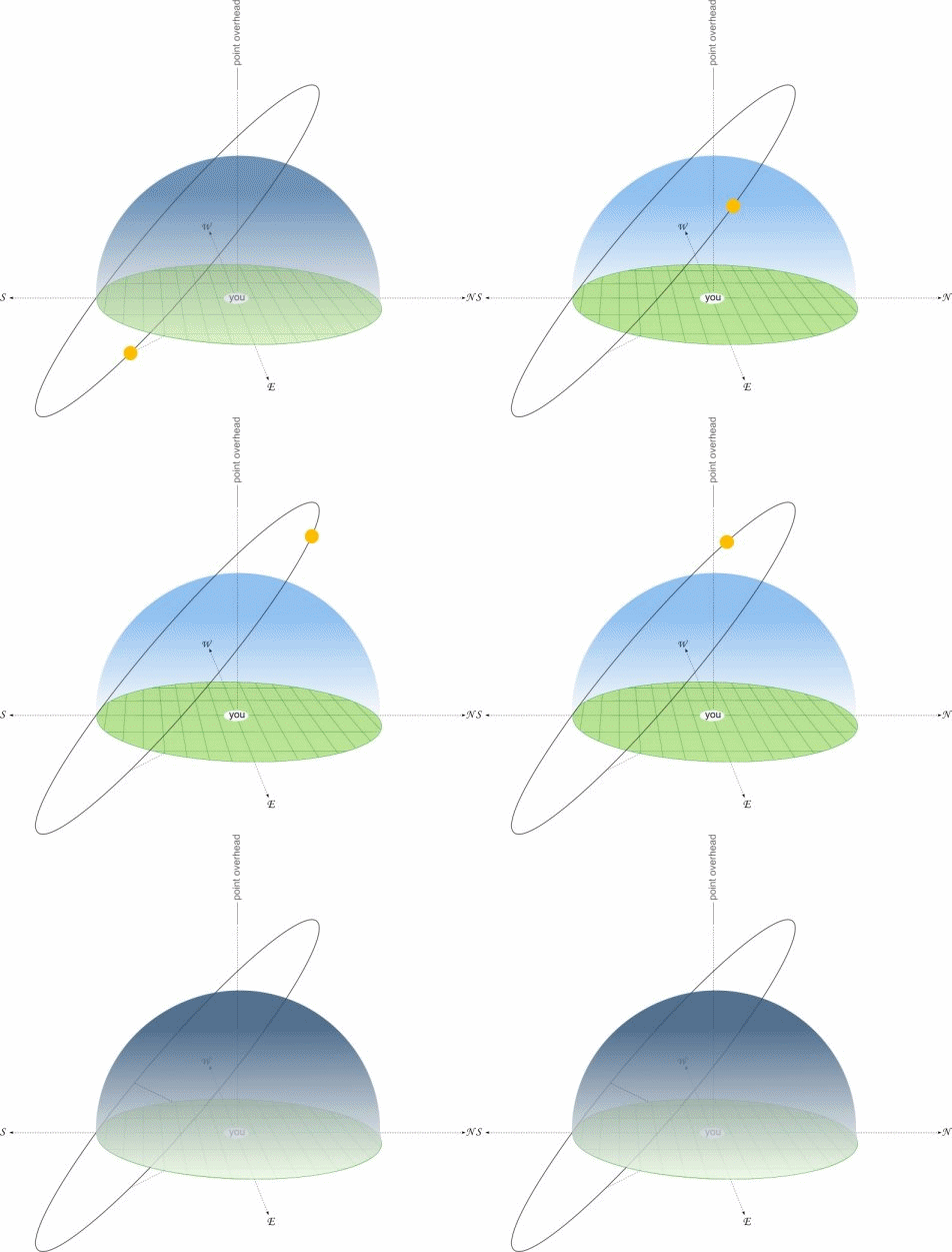
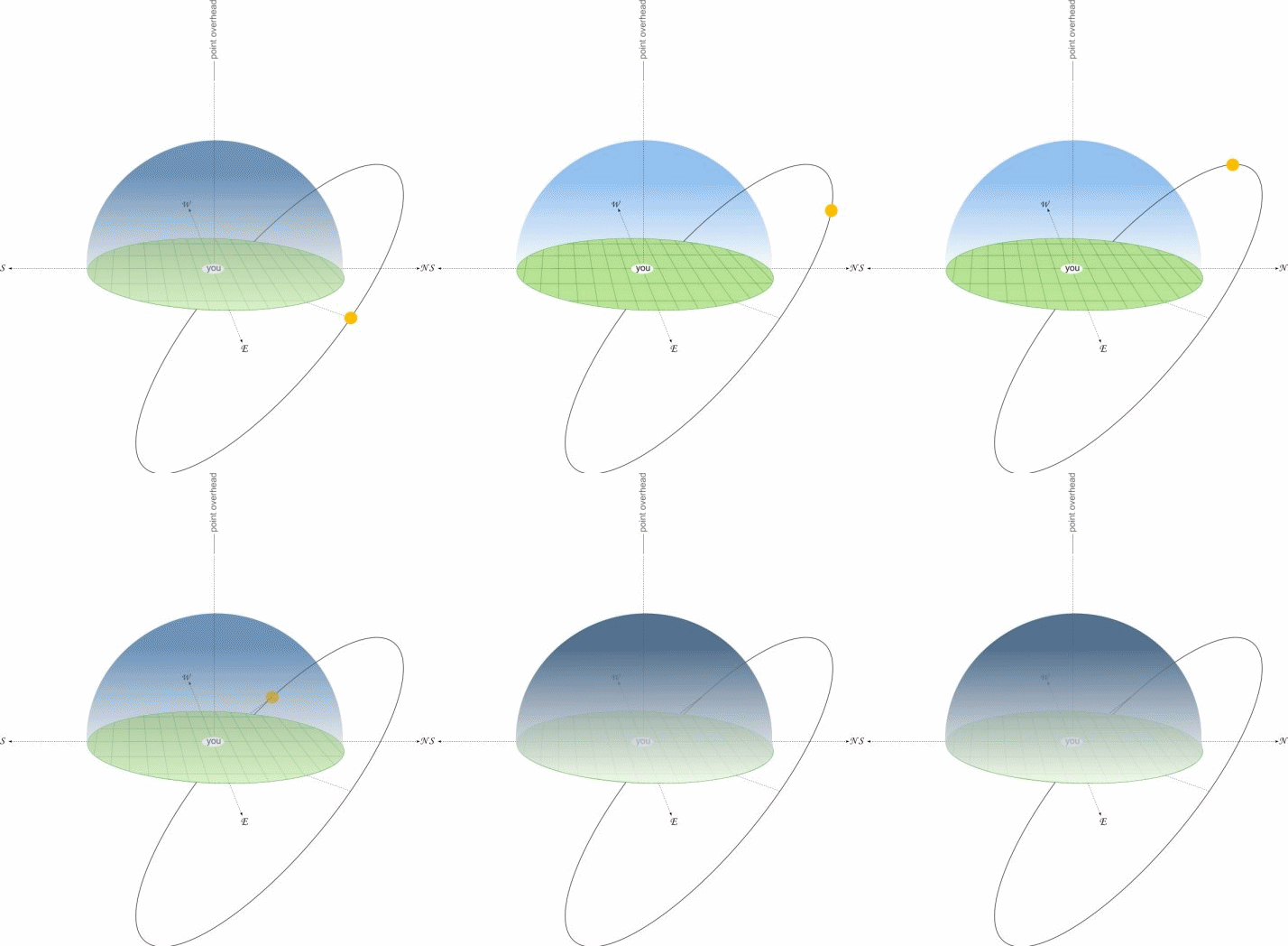
You can get phone apps that calculate the suns path for your current location and then present the data augmented over the phones camera image. I make one for Windows Phone called Sun Tracker.
ReplyDeleteThe Sun Tracker app looks awesome, wish I had a windows phone ; )
Delete